


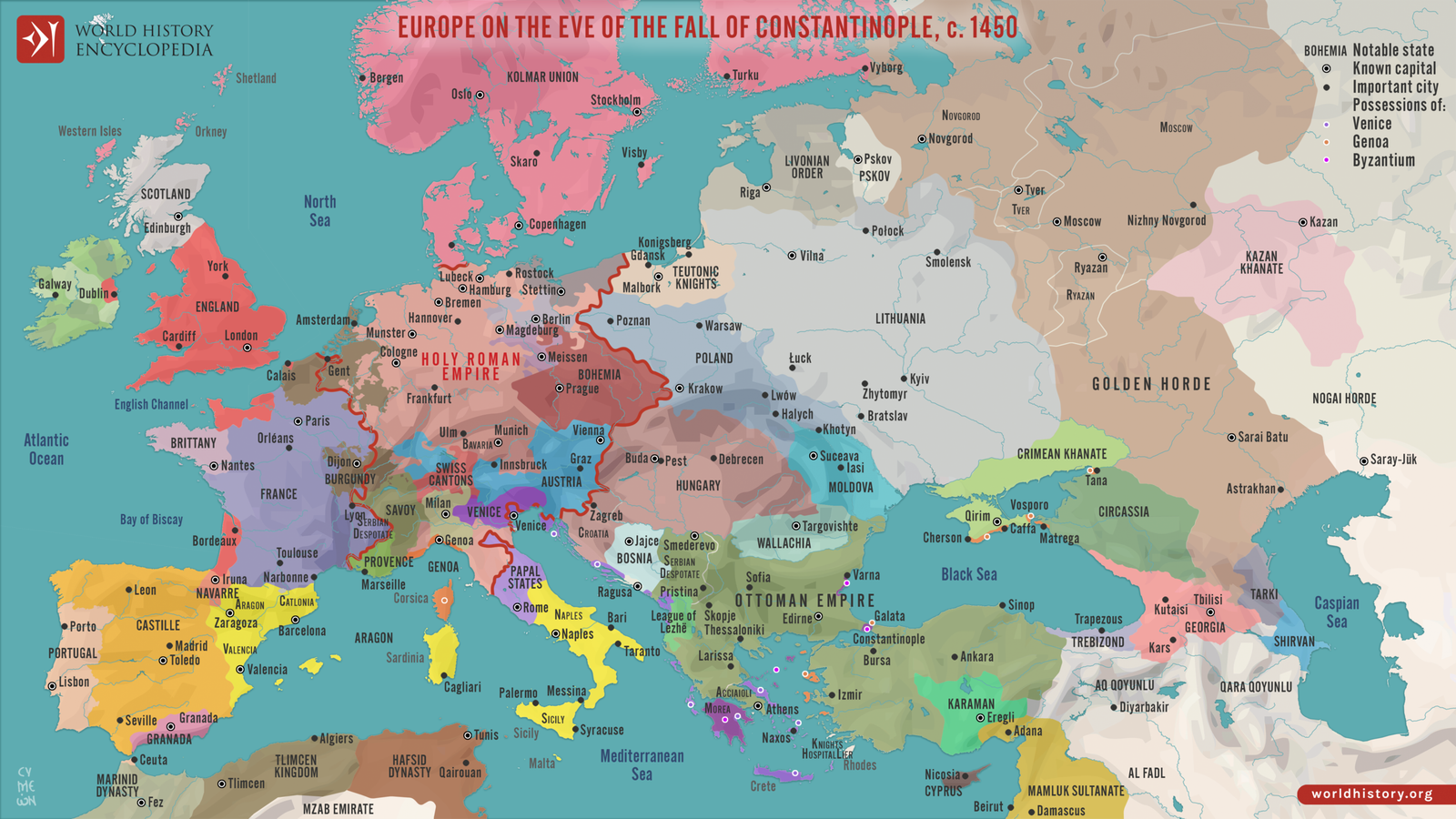
Introduction to the Map of Europe
The map of Europe serves as an essential tool for both navigation and education, revealing the intricate layers of geography that define the continent. More than just a representation of routes and borders, this cartographic resource unveils a tapestry of historical and cultural dynamics at play among the diverse nations that inhabit Europe. Each map typically illustrates the various countries, highlighting their political boundaries, major cities, and notable geographical features such as mountains, rivers, and plains, which all contribute to the identity of the continent.
When exploring the map of Europe, one can observe not only the spatial relationships between different regions but also how these areas have been influenced by historical events, migration patterns, and socio-economic interactions. For instance, the presence of the Alps and the Pyrenees not only dictates travel routes but also shapes climate and biodiversity, while cities like Paris, Berlin, and Rome each serve as cultural hubs, capturing the essence of European heritage.
Additionally, the map of Europe facilitates a broader understanding of the continent’s cultural landscape, showcasing the multitude of languages, religions, and traditions that exist side by side. Each nation tells its own story, reflecting a blend of influences that stem from millennia of history. As one delves into maps of various scales and details, the connections between this geographical representation and the lived experiences of its inhabitants become evident, enriching one’s appreciation of Europe’s complexity.
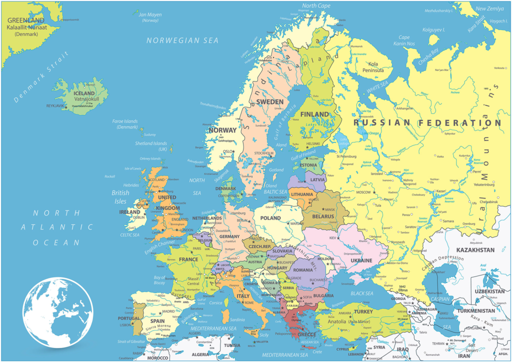
Geographical Features of Europe
The map of Europe illustrates a rich tapestry of geographical features that significantly influence the continent’s climate, biodiversity, and human settlements. Among these features, the mountain ranges of the Alps and the Pyrenees stand out as prominent landmarks. The Alps, stretching across eight countries from France to Slovenia, are known for their breathtaking peaks and diverse ecosystems. They not only provide stunning landscapes but also serve as barriers that affect weather patterns, contributing to variations in climate across Europe. The Pyrenees, which form a natural border between France and Spain, are equally important, characterized by rugged terrain and a unique blend of flora and fauna.
Rivers are another significant feature depicted on the map of Europe. The Danube, which is the second-longest river in Europe, flows through ten countries and is vital for commerce and transportation. It also plays a crucial role in supporting biodiversity along its banks and in its tributaries. Similarly, the Seine River, flowing through Paris, is not only historically significant but also enhances the urban landscape, providing serene views and recreational opportunities to locals and tourists alike.
Other notable landmarks include the vast plains of Eastern Europe and the unique geological formations found in places like the Carpathians. These diverse geographical features contribute to the rich environmental variety found within Europe, influencing agricultural practices and habitat distributions. Human settlements have thrived in areas with access to fertile lands and waterways, showcasing how topography directly impacts the socio-economic development of the continent.
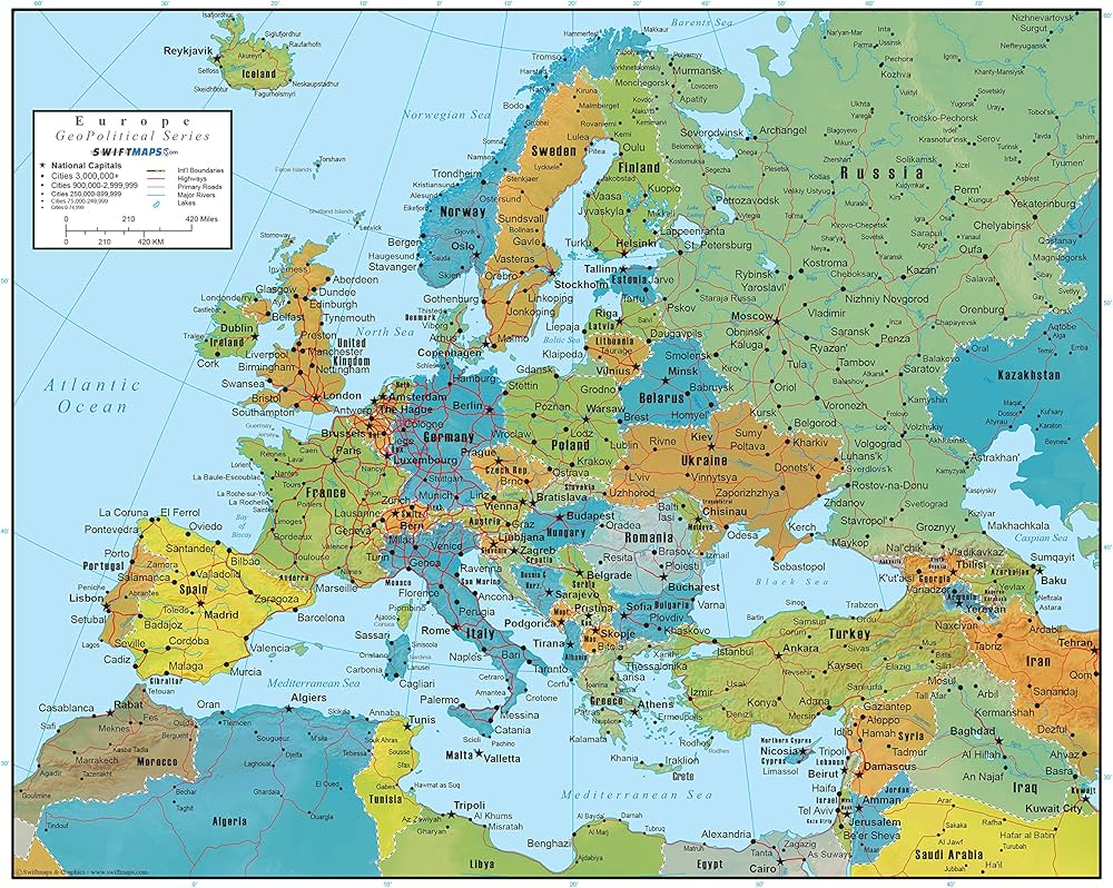
Cultural Significance and Historical Context
The map of Europe serves not only as a geographical representation but also as a significant cultural artifact that encapsulates the continent’s rich tapestry of history and diversity. Each country depicted on the map has its unique cultural identity, shaped by centuries of historical events, languages, and traditions. For example, the intricate borders between nations highlight the complex history of colonization and imperialism, which has deeply influenced the cultural compositions of various regions.
Throughout Europe, one can observe the effects of historical conflicts, such as the World Wars, that led to changes in national boundaries and sparked migrations. These events have contributed to a multifaceted cultural environment where languages and customs interweave. In regions like the Balkans, the map’s portrayal reflects a mosaic of ethnicities and cultural identities coexisting and often competing for recognition and respect.
Furthermore, treaty agreements and political decisions, such as the establishment of the European Union, have reshaped the cultural context by promoting a shared European identity while preserving distinct national characteristics. This dynamic is visible in various cultural festivals, culinary diversity, and languages that vary from one country to another, as indicated on the map of Europe.
Thus, the cultural landscape of map of Europe as represented on the map is not static but rather a living testament to the historical influences that have shaped it over time. By exploring the map, one gains insight into how history has forged the present identities of European nations, offering a deeper understanding of the continent’s cultural significance.
Traveling Through Europe: A Practical Guide
Traveling across Europe can be an enriching experience, and having a thorough understanding of the map of Europe is essential for seamless navigation. With its diverse geography, numerous countries, and rich cultural heritage, Europe offers countless opportunities for exploration. To facilitate your journey, various transportation options are available, including trains, buses, and flights, each with different benefits depending on the regions you plan to visit.
One of the most efficient ways to navigate the map of Europe is by utilizing the extensive rail network that connects major cities and regions. The Eurail Pass, for instance, allows travelers to experience this mode of transportation, offering flexible travel options across multiple countries. Alternatively, budget airlines provide quick connections between major European capitals, making air travel an attractive choice for longer distances. Additionally, local buses can be a cost-effective option for reaching smaller towns and villages not served by rail.
When using a map of Europe, consider highlighting your must-see destinations based on geographical regions. Western Europe is known for its iconic cities such as Paris, London, and Amsterdam, while Eastern Europe offers lesser-known gems like Prague and Budapest. The Mediterranean coastal areas, including Barcelona and Nice, provide stunning views and vibrant cultures, while Northern Europe showcases the breathtaking landscapes of Norway and Sweden.
Planning an itinerary that allows for a balance of sightseeing and cultural experiences can significantly enhance your travel experience. It is advisable to earmark significant landmarks, local cuisines, and unique events in each destination. Allow some flexibility in your plans to explore off-the-beaten-path locations, which may not always be highlighted on a typical map of Europe. This approach will not only enrich your journey but also provide a deeper understanding of the regions you visit.
